Your Cart is Empty


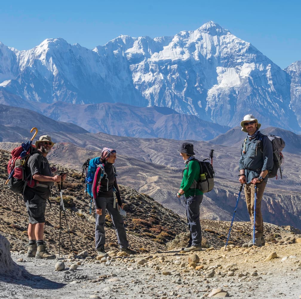
Jakob and Sonja recently completed the Australian Alps Walking Track (AAWT) through the Australian high country. Their walk was entirely unassisted, covered 800km, took 51 days and included many of the highest peaks in Australia including Mount Kosciuszko.
In the early planning stages of this walk it was only an endeavour of the enjoyment and personal achievement, but after seeing firsthand the damage caused by bushfires Sonja and Jacob’s walk took on a greater purpose: Hike For Huts, a fundraiser for the Foundation for National Parks & Wildlife who work to preserve the historical huts throughout the Australian high country. These huts are a link to Australia’s heritage, built by graziers, remote farmers, gold miners and early settlers, and provide important, sometimes life saving, shelter to hikers.
The idea for the Australian Alps Walking Track came up in October 2013, the start date of our hike in Walhalla was Friday, 17 October 2014. In between lay a year of preparation and planning.
We knew we needed equipment that would withstand the harsh and changing weather conditions on the walk, food that was nutritious and light weight, without being boring and repetitive and other bits and pieces that would make us totally self-sufficient.
Jakob is a published author on German adventurers and traders in the Southern Pacific. He has always enjoyed hiking and bushwalking. During the European summer of 2003, he hiked 1300km west to east across the European Alps (Montreux to Vienna).
Sonja works in sustainability at a large Australian infrastructure company. She completed the 100km Coastrek from Palm Beach to Coogee in 2013.
Together, Sonja and Jakob have hiked in the French Vosges, as well as many areas in Australia.

While the idea started as a challenge and an answer to the question of what’s next after the Coastrek, it soon made sense to give it a deeper meaning. We had hiked through the Snowy Mountains the first time during Christmas and New Year 2002-03 and were amazed by the natural beauty of the land, its remoteness and its harshness. Caught in bad weather and a white-out near Mt. Kosciuszko on New Years Eve, we were fortunate to have gear that provided us with safety.
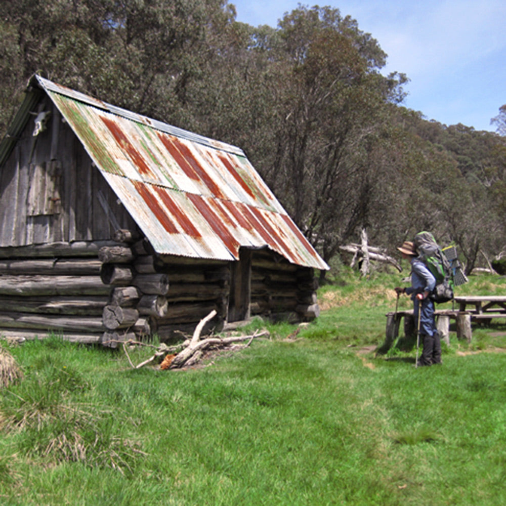
A ranger we spoke to relayed the history behind Seaman’s Hut and some of the other huts that were built by grazers and remote farmers. Apart from having local and historic significance, these huts today provide emergency shelter for hikers.

We were devastated to learn that just a few weeks after we passed through this amazing country, huge bushfires burned through the area, destroying natural habitat, rare flora and fauna, and numerous huts.
It was during our first test walk in October 2013 when the idea arose that we could assist in preserving some key-features of the region. Ten years after the bush fires, the devastation is still clearly visible in the remnants of burnt out tree trunks. It was huts like Mawson’s, Valentine’s and O’Keefe’s that had also been destroyed and rebuilt – rebuilt to provide shelter and keep historic evidence alive. They enable us and fellow hikers to enjoy these trails as documented in the hut books; their upkeep is of importance.
We are therefore proud to support the Foundation for National Parks & Wildlife through our walk, Hike for Huts, in their endeavours to maintain and preserve the historic and recreational significance of this region.

The most important pieces of equipment are of course the tent, sleeping bag, backpack, GPS and bad weather gear.
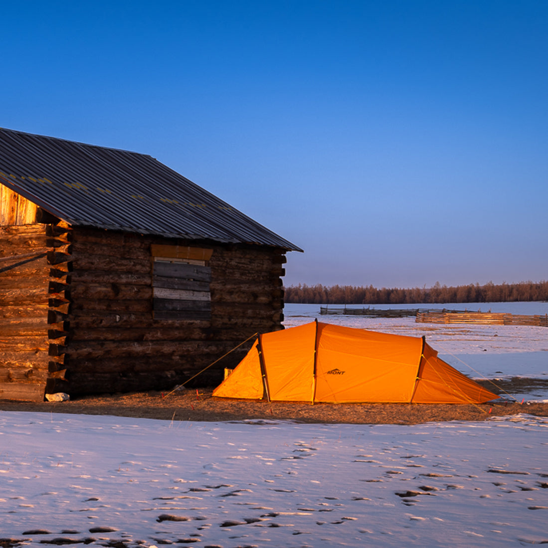
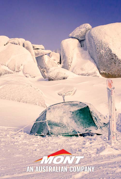
We took a three person, four season tent large enough for us to keep our packs inside and cook within the vestibules.
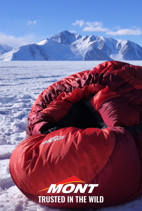
For excellent weight-to-warmth, we chose Mont Highland sleeping bags with temperature rating of -10°C and a weight of only 1200g each. We were very happy with our choice, they kept us warm with temperatures regularly dropping to zero and heavy winds buffeting the tent.

Having had some issues with Goretex shellwear in the past, we were looking for something that would better meet our requirements. Mont’s Hydronaute membrane sounded like a good option and it was. We stayed dry and comfortable whilst hiking even in day-long drizzle and continuous rain.
We used a SteriPen for sterilizing water on the track. A PLB helped us to let family and friends know our location. Thanks to a solar charger and rechargeable batteries, we never had to resort to spare lithium batteries which we also carried, just in case.
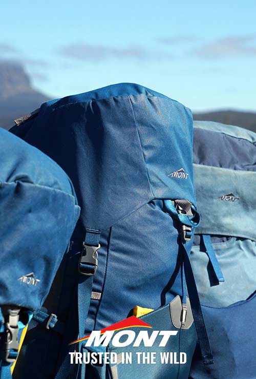
In addition to the usual set of clothing we took gloves, merino mid-layers, thermals, fleece jackets, spare shoes for crossing rivers, Nordic poles, a methylated spirit cooker and a comprehensive first aid kit. Except for the sleeping mats, everything fitted into our backpacks of 80 and 90L respectively.

There is not even the most basic infrastructure along or close to the AAWT. That is why our food supply needed to be self-sufficient. We chose food that was high calorific, low weight, non-perishable and enjoyable. The last one was important, because good food can make or break a day. Based on the average Australian calorie consumption guideline of about 2000kcal per person/day, we assumed a 3000kcal/day consumption for our trip. A full day’s portion was not to weigh more than 1kg per person.

A typical day would include muesli, powdered milk and tea for breakfast and a muesli bar for morning tea. Lunch consisted of wraps (with salami or sardines and cheese), couscous (with tuna and sundried olives) or scrambled egg (with biltong and freeze-dried vegetables). Nuts and dried fruit (mango, papaya, oranges) made up afternoon tea and an assortment of 20(!) different dinners constituted dinner. Chef Sonya Muhlsimmer, in the middle of writing a new recipe book for bushwalkers, provided us with recipes for Pasta Puttanesca, Dumpling Hotpot and Camp Stroganoff, along with desserts like Chocolate Cake and Crumbles.
Most foods, such as pasta, rice, powdered milk and egg, vegetables and spices we derived at a local grocery. Specialised stores assisted with freeze dried ingredients and fruits.
We vacuum packed, labelled and allocated individual portions for lunches and dinners over three weekends, to finally store them in tamper-proof containers. These were allocated to nine designated food drops, between four and nine hiking days apart. These locations were dependent on the accessibility of roads and the intersection with the AAWT. It took nearly five days and 1800 km to drive as we deposited the drops on the way down to the start. The containers were hidden under branches and bushes – not buried, as National Parks prefer for the soil not to be disturbed.

There are plenty of dry ridges along the AAWT and even though there are water sources available away from these ridges they can be depleted toward the end of summer. Taking this into consideration, we started the hike in early spring and were able to refill our bottles at least once a day (about six litres per person). However, not every source shown in our guide actually had water. We spent ninety minutes searching for water in the gully below the Murray Hut in the first week of November, but in vain. Staying at Mt Wills Hut six days later, the water tank was so close to empty that we had to “fish” water from the bottom with a rope and pot.

A common misconception about the AAWT is the notion that it is a designated track, leading from its start in Walhalla, Victoria to end in Tharwa, ACT. Rather, this ‘track’ is a combination of well-maintained trails, a lot of barely visible foot pads (a track formed by wear and tear of multiple people hiking it) and heavily overgrown fire access roads. It very often goes through scrub and bush and wide grassy plains with no pad at all – especially when choosing some of its most scenic and rewarding detours in the Snowy Mountains region, as we did.
Quality of marking and cairning along the way varies significantly. A number of sections are newly marked and it is practically impossible to get lost. On the other hand, all such navigational aid is lacking in several stretches through Wilderness Areas, such as the Cobberas.
When using a GPS it can prove disastrous to blindly rely on recorded tracks from the internet. However, taking such data as a starting point for programming one’s own route by crosschecking it against digital maps and satellite views (Google Earth) showed to be a smart and time efficient strategy for us. It also assisted with learning about the hike.
In the wilderness, increased accuracy of most hand-held GPS devices these days will even allow for walking in fog – an absolute no-no when using traditional instruments. However, such a strategy is only safe when displaying considerable respect for obstacles that might conflict with the route: slippery cliffs, rocky sections, snow fields and overgrown passages. To assist in finding a way around them, but also back to the route, the via-points on the GPS should not be programmed further than 50-100m apart.
Last but not least, taking a GPS on the walk must not mean saving on the additional weight of a compass, altimeter and a set of topographic maps with a scale of at most 1:50,000.

Our alarm would go off at daylight around 5am. We took plenty of time getting ready in the morning and were usually on the track between 7 and 8am. When possible, we pitched our tent an hour or two before sunset so we could enjoy nature and the scenery, cook and eat outside. Cold rivers and creeks replaced hot showers. Every 6-8 days we had a scheduled rest-day and we managed to ‘wash’ our clothes twice during the trip.
There were literally no arguments on the track, because we had allocated different responsibilities to each of us. Jakob was in charge of programing the route and the GPS, general navigation and giving directions, while Sonja had the function of a scout, finding the best route between two points. Sonja was in charge of food and nutrition, while Jakob did the cooking. Jakob kept a diary on the condition of the track, while Sonja focussed her diary on the daily experience.

We had a great time on our trip. The planning took the stress and anxiety out of the trek and we could enjoy the journey. We were still faced with a lot of challenges, but we were in control of all the crucial tasks all the time; We never ran out of food and we lost our track only once or twice for a maximum of fifty metres. To read more about our trip or to contact us, go to www.hikeforhuts.org
Sonja and Jakob
www.hikeforhuts.org

Want more? Sign up to the Mont Newsletter to get gear reviews, news about product releases, great photos and advice on all your outdoor needs.
Mont. Trusted In The Wild
Comments will be approved before showing up.